
Nicola(a)s de Fer (1646-1720) |
Nicolaas de Fer's father, Antoine de Fer, was a publisher and mapseller in Paris. After his death in 1773 his widow continued the declining business, which eventually was passed on to Nicolas. In 1690 he became geographer to the French Dauphin, 1702 geographer to the King of Spain, formerly Duke of Anjou. After the death of the Dauphin in 1711 he became official geographer to both kings. De Fer is known for excellent atlases as well as 26 large-scale wall maps.
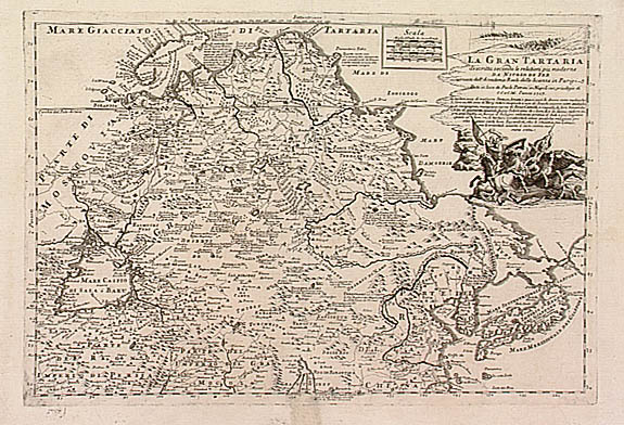
This map includes Korea and Japan. A peninsula called "Yupi" protrudes out of Tartary. This was the Chinese name of a northern people who used fishskins (Chinese: yupi) for clothing.
